
Politechnika: The Warsaw Neighbourhood Planned Three Times
A royal street plan, an imperial technical university and a socialist-realist housing district all meet within a short walk. Follow the buildings, art and everyday stories that make Politechnika one of Warsaw's most revealing neighbourhoods.
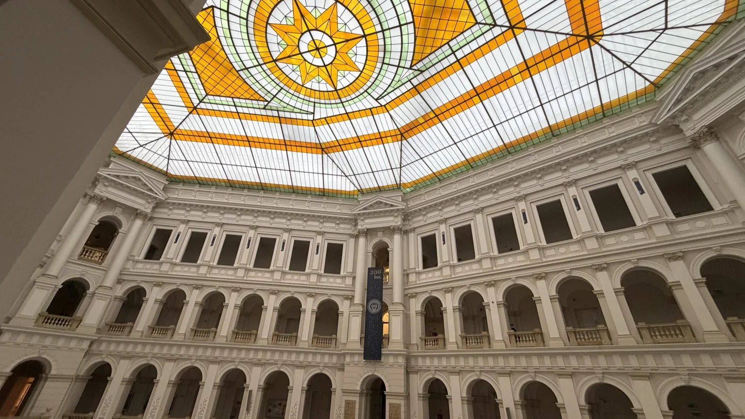
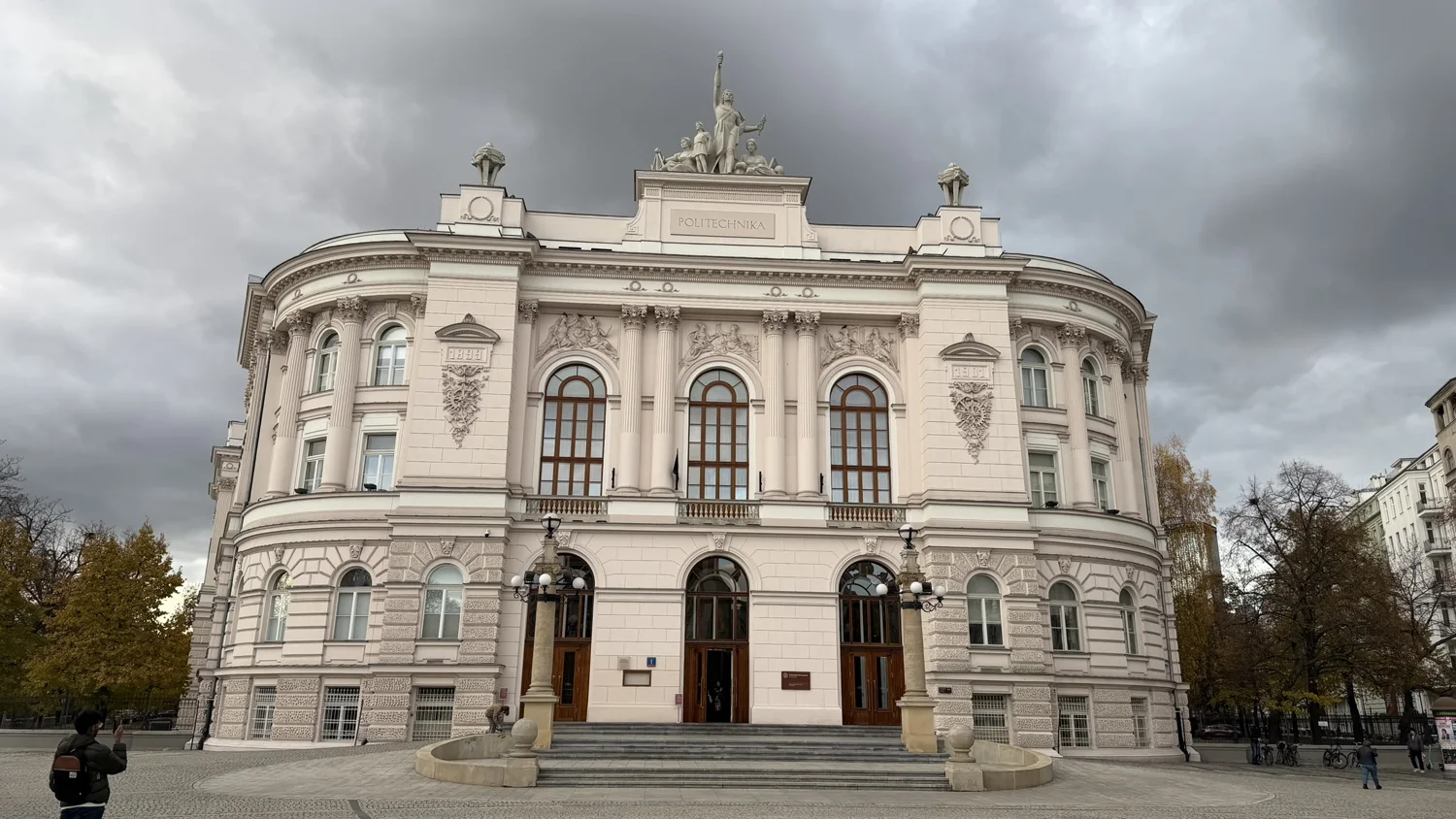
Look up inside the Great Hall of Warsaw University of Technology. Three levels of arcaded galleries rise beneath a patterned glass roof, a spectacular expression of the confidence that technical education inspired at the turn of the twentieth century. The roof you see today is a 1994 reconstruction, not untouched original glasswork. If university activities prevent access, the imposing main façade is worth seeing in its own right.
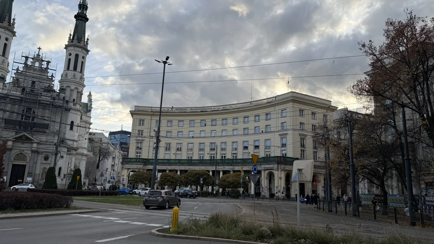
Walk towards Plac Konstytucji and the ambition changes shape. Giant street lamps, long arcades and sculpted workers announce the socialist-realist district of the 1950s. Between the two are residential streets that retain something of prewar Warsaw. Beneath them all lies an older scheme: an eighteenth-century royal plan that still influences the shapes of Plac Politechniki and Plac Zbawiciela. Three plans; one neighbourhood lived in by students, residents, worshippers and café-goers ever since.
Explore on foot
Politechnika walking map
Two ways round, both measured on mapped pedestrian paths: a highlights walk of about 1.7 km between the Main Building and Plac Zbawiciela, or the fuller 2.0 km route with the side streets, Hala Koszyki and the museum. Select a stop for what to look for, its access status and the matching part of this guide.
The walk, Plac Politechniki to Plac Zbawiciela
- Warsaw University of Technology Main BuildingGmach Główny, Plac Politechniki 1Working university · interior access varies
- Lwowska & Noakowskiego forkCorner building Lwowska 3 / Noakowskiego 4Outdoor · free to view
- Lwowska 15 & 17Optional architecture detail · view from the streetOutdoor · free to view · optional
- Hala KoszykiKoszykowa 63Food hall · commercial venue
- Plac KonstytucjiMDM main squareOutdoor · free to view
- Four Seasons mosaicsArcade ceilings at Plac Konstytucji 5 (and opposite at no. 6)Outdoor · free to view
- Museum of Life under CommunismMuzeum Życia w PRL, Piękna 28/34Museum · ticketed · optional
- Plac Zbawiciela & Church of the Holy SaviourKościół Najświętszego Zbawiciela, Plac Zbawiciela 1Church · open for worship
Optional extensions
- Warsaw University of Technology MuseumNowowiejska 21/25 · visits by arrangementWorking university · interior access varies
- Stacja FiltrówLindley’s water filters, Koszykowa 81Working utility · no public access
- Pole MokotowskieOptional green extensionPark · free
- Geological MuseumPolish Geological Institute, Rakowiecka 4Museum · check opening and admission
2 Circle: outdoors · 1 Square: a building you may enter (access or ticket varies) · 3 Ringed: optional · Measured walking route
Distances, measured along OpenStreetMap streets and paths: the full walk (stops 1–8) is about 2.0 km; the highlights walk (skipping 3 and 7) is about 1.7 km. Allow roughly two hours for the highlights with time at each stop, longer with the museum and food-hall stops.
The Stanisławowska Axis. Begun in 1768 on the initiative of King Stanisław August, this planned layout of five circular squares and connecting roads linked Warsaw with Ujazdów Castle. Plac Politechniki and Plac Zbawiciela both began as squares on it. The map does not draw the original axis, because its exact historical line is not sourced here.
The route line follows real streets and crossings, measured from OpenStreetMap; numbered pins are stops, lettered pins are optional places outside the core walk. Interiors, opening hours and tickets change, so check before you go.
A royal plan beneath the streets
In the later eighteenth century, under King Stanisław August Poniatowski, planners laid out the Stanisławowska Axis (Oś Stanisławowska), a system of avenues and striking multi-way squares associated with the royal landscape towards Ujazdów. Plac Politechniki and Plac Zbawiciela retain traces of this geometry even though most of the surrounding buildings date from much later. Stand in either square and trace the streets radiating from it: the plan under your feet is older than the university, the apartment blocks and MDM.
The polytechnic: from imperial ambition to Polish science
The university that began in a tobacco factory
The Warsaw Polytechnic Institute was established in 1898, under Russian imperial rule, with backing from local supporters of technical education. The city provided land, and a fundraising campaign helped finance the new institution. While the purpose-built campus was taking shape, lectures began in the former Union tobacco factory at Marszałkowska 81. Its first teaching language was Russian.
The Main Building, designed by Stefan Szyller, was ready for use in 1901 and formally opened in 1902. Szyller also designed the Physics Building; Bronisław Rogóyski designed other campus buildings, including Chemistry and Mechanics. The richly ornamented Main Building makes the university's ambitions instantly legible. Look for the monumental entrance and sculptural programme as well as the hall inside.
In 1905, the institute was caught up in protests demanding Polish-language teaching and greater autonomy. The Russian-run school subsequently lost the confidence of many Polish students. The Russian institute was evacuated during the First World War; on 15 November 1915, a Polish-language Warsaw University of Technology was inaugurated in the buildings. This is not the University of Warsaw on Krakowskie Przedmieście: the two institutions have different histories and campuses.
War, reconstruction and a congress in the Great Hall
During the German occupation, parts of the university's teaching continued clandestinely. In the 1944 Warsaw Uprising, Home Army fighters including the Golski battalion defended the campus amid heavy fighting; German forces took the area in August. Academic staff, collections and buildings suffered across the war. Staff deaths must be attributed to the whole wartime period, not all to the Uprising.
Rebuilding after 1945 also completed an unfinished portion of Szyller's original Main Building scheme towards Nowowiejska. The present complex therefore combines early twentieth-century construction with substantial postwar work and later restoration.
Then, in December 1948, the Great Hall hosted the congress that founded the Polish United Workers' Party (PZPR), which would dominate political life in communist Poland. In 1949, the adjacent square received the name Plac Jedności Robotniczej — Workers' Unity Square. It later regained the name Plac Politechniki. The same hall that embodied technical progress became the setting for a defining political event, shortly before work began on MDM.
Worth a look: Warsaw University of Technology Museum. The museum office is at Nowowiejska 21/25. Its exhibition room is opened on request, and organised walks around the Main Building are offered; contact the museum before making a special journey. Official information: https://muzeum.pw.edu.pl/Kontakt
The streets between the plans
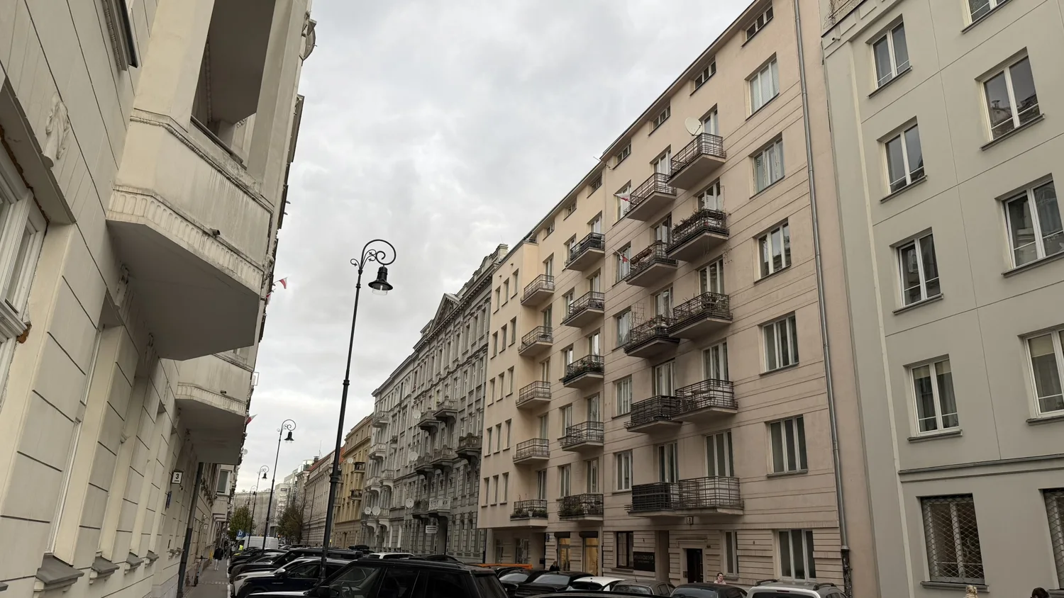
Head along Lwowska, Noakowskiego and Koszykowa. The scale drops from public monument to apartment façade: bay windows, entrances, balconies and courtyards speak of a city growing around the new technical institute. The corner at Lwowska 3 / Noakowskiego 4 and the buildings at Lwowska 15/17 are useful points for a closer architectural look, but their designers and individual details should be matched to the specific buildings before we publish attribution labels. The pleasure here is in comparing the surviving residential streets with the regimented scale of MDM ahead.
Hala Koszyki: an old market reinvented
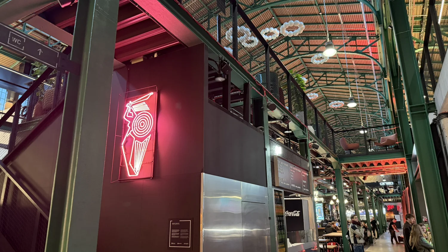
At Koszykowa 63, Hala Koszyki began life as an early twentieth-century covered market. The present food hall is not an intact historic interior: redevelopment retained some historic elements, including side wings and entrance features, while substantially reconstructing the main hall. It's an atmospheric place to stop for food, and a fitting example of how this neighbourhood has changed. Our Industrial Warsaw guide covers the building's architecture and redevelopment in greater depth.
Plac Konstytucji: the socialist city on display
Housing and ideology on Marszałkowska
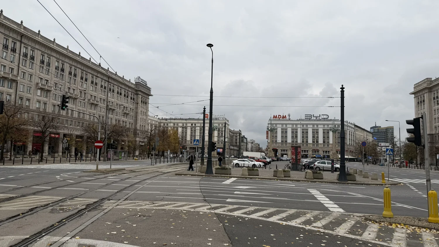
Construction of the Marszałkowska Residential District (MDM) began in 1950. Its first residents moved in during 1951, and the opening of the principal phase was celebrated in July 1952. The name Plac Konstytucji refers to the constitution adopted that month. Led by architects including Józef Sigalin and Stanisław Jankowski, the programme envisioned far more than one monumental square; only part of the wider project was realised.
The composition presented a new centre for a working-class socialist city: generous housing blocks, shops, service premises, arcades and broad public space. Its scale also reshaped existing streets. Some prewar buildings were replaced during redevelopment; any specific address-level demolition claim needs its own archival evidence rather than a blanket assertion that the whole district had been cleared by wartime destruction.
Look up: MDM reliefs and ceiling mosaics
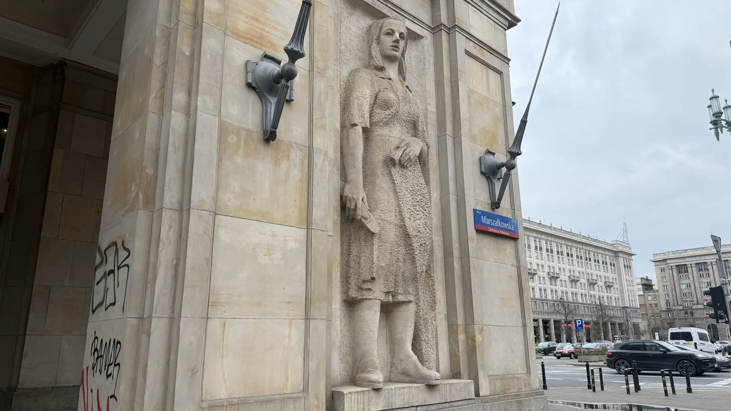
MDM was designed to communicate political and social ideals through architecture. Look above the arcades for figures of workers and industrial labour, then along the façades for deliberate repetition of columns, cornices and entrances. Sculptors including Karol Tchorek contributed to the district's artistic decoration, although individual photographed figures should not be attributed to him without a work-specific source.
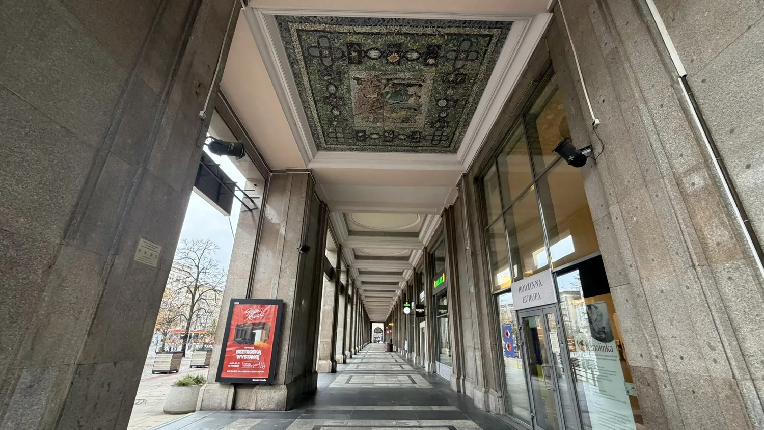
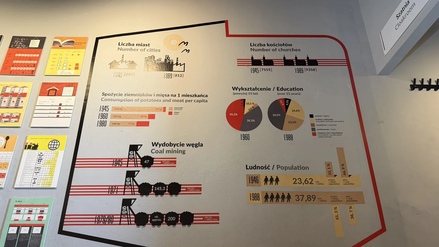
Look up beneath the arcades at Plac Konstytucji 5 and 6: four large ceiling mosaics forming the Four Seasons cycle were designed by Hanna Żuławska and produced with her collaborators in 1952. The murals and mosaics reward a close view, in contrast to the square's grand gestures above. The official message celebrated work and collective progress; over the decades the buildings also became ordinary homes and shops, used in ways no architect could control.
Stanisław Jankowski “Agaton”
Stanisław Jankowski studied architecture at Warsaw University of Technology and served in the wartime underground as Agaton, a Cichociemny parachutist and Home Army officer. He worked in resistance intelligence and document forgery and fought in the Warsaw Uprising. After the war, he helped rebuild Warsaw, contributing to the W-Z Route and MDM. His career links the polytechnic, wartime resistance and socialist-era reconstruction without allowing the politics of the finished buildings to stand in for his own beliefs.
The Museum of Life under Communism
At Piękna 28/34, near Plac Konstytucji, the Museum of Life under Communism offers reconstructed rooms and everyday objects from the Polish People's Republic. It's a useful counterpoint to MDM's official monumental imagery: visitors can examine the material culture of apartments and daily routines rather than just state architecture. Check the museum's opening times, ticketing and photography rules before visiting. Official website: https://mzprl.pl/
Plac Zbawiciela: where the plans meet
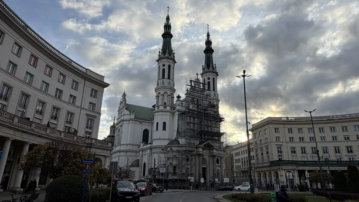
The walk ends at one of Warsaw's most recognisable junctions. The star-shaped plan recalls the eighteenth century, while the arcades and surrounding façades bring together buildings from different stages of the city's twentieth-century history.
The Church of the Holy Saviour was begun in 1901, consecrated in 1927, badly damaged during the Second World War and rebuilt afterwards. It remains a working church. See the façade and towers from across the square; if entering, avoid services and respect worshippers. Parish history: https://parafiazbawiciela.org/historia/
In 2012, artist Julita Wójcik's Tęcza (Rainbow) was installed here. Conceived as a work associated with openness and tolerance, it became widely read as a symbol of LGBT inclusion and a point of dispute because of its prominent position near the church. It was repeatedly attacked and set alight before its removal in 2015. The controversy became part of the square's modern history, while cafés, parishioners and passing residents continued to share the space.
Take a little time here. A square first drawn on a royal plan has become a place with many competing meanings — as well as somewhere to have a coffee and watch everyday Warsaw go past.
Optional extension: the Geological Museum
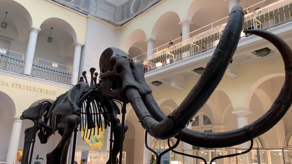
For a science-themed detour beyond the main walk, head south to the Geological Museum at the Polish Geological Institute, Rakowiecka 4 (entrance from Wiśniowa). Its collections of fossils, minerals and prehistoric life make an engaging counterpoint to the engineering history of Politechnika. The museum is in Mokotów, rather than the core Politechnika neighbourhood, so treat it as an optional extra rather than part of the short route. Check the official museum information before travelling.
Plan your visit
The main outdoor walk is compact. Suggested order: Plac Politechniki and Main Building → Lwowska and Noakowskiego → Hala Koszyki → Plac Konstytucji and MDM → Plac Zbawiciela. The exact route, stop coordinates, walking distances and durations will be finalised in the dedicated map stage; the following are time budgets for visiting, not verified walking ETAs.
About two hours: main university exterior (Great Hall if accessible), a short architectural look at Lwowska/Noakowskiego, Plac Konstytucji reliefs and lamps, and Plac Zbawiciela.
About four hours: the same walk plus more time for the Great Hall, Hala Koszyki, the Four Seasons ceiling mosaics in the MDM arcades and the Museum of Life under Communism if open.
| Place | Address / area | Practical status | Official information |
|---|---|---|---|
| Warsaw University of Technology Main Building | Plac Politechniki 1 | Working university; exterior visible, interior access may vary | https://pw.edu.pl/kampus/gmach-glowny |
| WUT Museum | Nowowiejska 21/25 | Exhibition room by request; arrange guided visits | https://muzeum.pw.edu.pl/Kontakt |
| Historic residential streets | Lwowska / Noakowskiego / Koszykowa | Outdoor façades; respect private courtyards | — |
| Hala Koszyki | Koszykowa 63 | Public commercial complex; individual venues vary | https://koszyki.com/ |
| Plac Konstytucji / MDM | Plac Konstytucji | Outdoor architecture; free to observe | — |
| Museum of Life under Communism | Piękna 28/34 | Ticketed museum; check current arrangements | https://mzprl.pl/ |
| Church of the Holy Saviour | Plac Zbawiciela | Active church; visit respectfully | https://parafiazbawiciela.org/ |
| Geological Museum (optional extension) | Rakowiecka 4, Mokotów | Outside the main route; check opening arrangements | Official website |
Optional extensions: Stacja Filtrów, a working utility with restricted access, is treated in Industrial Warsaw. Polna's market streets and Pole Mokotowskie provide other directions for a longer outing. The Geological Museum is a science-themed extension into neighbouring Mokotów.
Continue exploring: link to the existing Industrial Warsaw, Warsaw Museums and Warsaw Architecture guides, using their verified internal URLs in the final build.
A neighbourhood that outgrew its plans
The king's planners drew the squares. An empire built the polytechnic; Polish students and teachers gave it a new national identity. A communist party was founded in its Great Hall and built a monumental district nearby. None of these plans could decide how the streets would actually be lived in — and that is why Politechnika is worth exploring.